|
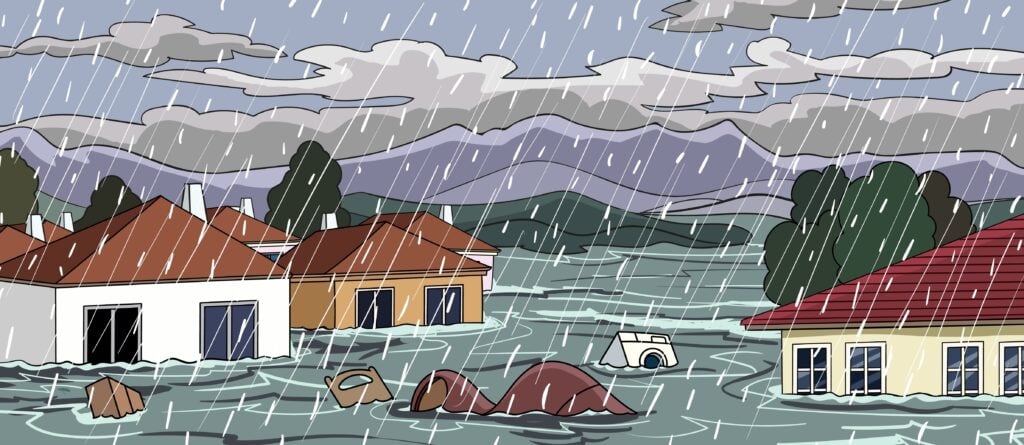
🌊 What risks does climate change pose to U.S. real estate? 🌊
Climate change is linked to more costly natural disasters, concentrated in risky areas. Nevertheless, many of the most in-demand metro areas for buyers are in the states most threatened by disasters.
|
Property Lost to Disasters | High Risk in High-Demand Areas | Wildfires | Hurricanes | Coastal Flooding | River Flooding | Winter Storms | Areas With Lower Disaster Risk | Additional Climate Costs | Methodology | FAQ
Fueled by climate change, extreme natural disasters are increasingly wreaking havoc on American people and property. Fires are burning larger. Hurricanes are hitting harder. Droughts are lasting longer.
In 2021 alone, 41 U.S. states had at least one non-COVID disaster declared by federal emergency officials.
Homeowners fortunate enough not to experience disaster losses still face higher costs associated with climate change, including pricier homeowners insurance and expensive energy costs.
As home buyers spend more to keep up with climate costs in the short term, the long-term impacts threaten to upend the market. By 2100, researchers estimate up to 13 million U.S. residents could see their homes left uninhabitable due to rising sea levels, exacerbating housing scarcity.
Meanwhile, Americans continue to live in — and move to — the areas most at risk of disasters. Coastal counties, for example, make up 10% of the nation’s land but hold 40% of the population. Our analysis shows many of the states most threatened by disasters are home to some of the most in-demand metro areas for home buyers.
Climate change has already begun to magnify the nation’s affordable housing crisis. To understand more about its impact, we analyzed weather and real estate data from the National Oceanic and Atmospheric Administration, Federal Emergency Management
Agency, Zillow, and other sources.
See our full findings below on how climate change will continue to affect home-buying and real estate at large.
🌪️ Climate Change vs. Real Estate Statistics
|
Billion-Dollar Disasters Are Growing More Common, Especially on the Gulf Coast
More frequent and intense natural disasters are the most glaring examples of climate chaos hurting homeowners. Since 1980, the number of billion-dollar weather and climate disasters occurring year-over-year has increased 567% (adjusted for inflation).
In all, natural disasters and events have cost the U.S. over $2 trillion since 1980.
Home prices have followed a similar pattern. Though the two trends don’t directly influence one another, the combination forecasts a bleak future in which fewer Americans can afford homes while also having fewer hospitable areas to live in, driving
up demand and prices in regions less impacted by extreme weather.
Costly disasters have ramped up in recent years. Adjusted for inflation, the U.S. averaged 4.7 billion-dollar disasters annually from 1980 to 2007. Since 2008, it’s 13.6 annually. In 2020 and 2021, that number increased to 21 per year.
More than $1 trillion of that sum is the result of tropical cyclones such as hurricanes, which have the highest average cost of all disasters at $20 billion per storm.
Much of the economic damage has fallen on the Gulf Coast. Since 1980, disasters have caused over $250 billion in damages in Texas, Louisiana, and Florida each. Since 2012, Texas has been impacted by 73 separate billion-dollar disasters — just over half of the 145 nationwide.
As for individual counties, NOAA reports those with the highest general hazard risk from disasters are:
- Harris County (Houston), Texas: Hazard score of 100 out of 100
- Miami-Dade County, Florida: Hazard score of 71.5
- Bronx County, New York: Hazard score of 67.2
Areas With the Most Disasters — and Highest Expected Losses
Areas with a high frequency of disasters remain some of the most in-demand for home buyers. Data from FEMA illustrates how.
Since 2012, metro areas in the three states with the most FEMA-declared disasters (California, Oregon, and Washington) have seen home prices outpace the U.S. median home price, rising an average of 167% compared to 113% across the U.S.
These three states account for 26% of environmental FEMA disasters in all states since 2012.
| State | Metro | # of Declared Disasters in State Since 2012 | Home Price Increase Since 2012 |
| California | Riverside | 146 | 183% |
| California | San Diego | 146 | 141% |
| California | Sacramento | 146 | 188% |
| California | Los Angeles | 146 | 147% |
| California | San Jose | 146 | 190% |
| California | San Francisco | 146 | 184% |
| Washington | Seattle | 85 | 162% |
| Oregon | Portland | 58 | 140% |
Since 2012, California alone accounts for 146 FEMA-declared weather and environmental disasters — 564% higher than the average state (22 disasters).
The average coastal state has witnessed 27 disasters in the last decade — 50% more than non-coastal states, which have an average of 18.
Quantifying Risks: Expected Annual Loss
To simplify the math behind assessing natural hazards, FEMA assigns each state a score from 0 to 100 representing Expected Annual Loss. The score quantifies losses and risk for buildings, people, and agriculture.
The five states with the highest EAL scores are:
| State | Overall EAL Score |
| California | 100 |
| Texas | 86 |
| Florida | 57.3 |
| Louisiana | 48.1 |
| North Carolina | 46.1 |
FEMA also generates EAL scores for each type of disaster. We’ll examine five of the most common below: wildfires, hurricanes, coastal flooding, river flooding, and winter storms.
The table below shows home price increases for the 50 largest U.S. metros, along with their state’s risk scores.
| State | Metro | Home Price Increase Since 2012 |
Overall EAL Score |
Wildfire EAL Score | Coastal Flooding EAL Score | Winter Weather EAL Score | Hurricane EAL Score | River Flooding EAL Score |
| Alabama | Birmingham |
65% |
34.6 |
18.4 |
13.5 |
38.6 |
40.5 |
30.9 |
| Arizona | Phoenix |
232% |
25.7 |
52.8 |
0 |
25.8 |
3.8 |
23.9 |
| California | Los Angeles |
147% |
100 |
100 |
9.9 |
26.2 |
0 |
46.9 |
| California | Riverside |
183% |
100 |
100 |
9.9 |
26.2 |
0 |
46.9 |
| California | Sacramento |
188% |
100 |
100 |
9.9 |
26.2 |
0 |
46.9 |
| California | San Diego |
141% |
100 |
100 |
9.9 |
26.2 |
0 |
46.9 |
| California | San Francisco |
184% |
100 |
100 |
9.9 |
26.2 |
0 |
46.9 |
| California | San Jose |
190% |
100 |
100 |
9.9 |
26.2 |
0 |
46.9 |
| Colorado | Denver |
150% |
32.7 |
40 |
0 |
38.1 |
0 |
31.7 |
| Connecticut | Hartford |
38% |
8.6 |
4.5 |
17.3 |
23.4 |
11.4 |
7.8 |
| D.C. | Washington D.C. |
53% |
0.6 |
0 |
3.2 |
23.3 |
11.4 |
0.1 |
| Florida | Jacksonville |
133% |
57.3 |
64 |
68.5 |
21.5 |
78.5 |
47.1 |
| Florida | Miami |
172% |
57.3 |
64 |
68.5 |
21.5 |
78.5 |
47.1 |
| Florida | Orlando |
193% |
57.3 |
64 |
68.5 |
21.5 |
78.5 |
47.1 |
| Florida | Tampa |
202% |
57.3 |
64 |
68.5 |
21.5 |
78.5 |
47.1 |
| Georgia | Atlanta |
142% |
36.9 |
34.4 |
22.9 |
69.1 |
30.4 |
25.7 |
| Illinois | Chicago |
79% |
42.5 |
3.6 |
0 |
66.5 |
15.4 |
36.1 |
| Indiana | Indianapolis |
108% |
31.8 |
2.7 |
0 |
59.3 |
13.1 |
30.9 |
| Kentucky | Louisville |
67% |
32.7 |
26.6 |
0 |
54.4 |
10 |
31.2 |
| Louisiana | New Orleans |
68% |
48.1 |
20.1 |
50.8 |
39.9 |
68.8 |
59.8 |
| Maryland | Baltimore |
42% |
21.7 |
15.4 |
41.4 |
52.5 |
19.7 |
17.7 |
| Massachusetts | Boston |
89% |
15.4 |
11.1 |
15.3 |
21.3 |
11.5 |
23 |
| Michigan | Detroit |
140% |
28.4 |
13.4 |
0 |
65.1 |
13.5 |
31.7 |
| Minnesota | Minneapolis |
113% |
33.4 |
29.2 |
0 |
66.6 |
1 |
23.3 |
| Missouri | Kansas City |
106% |
42.9 |
16.6 |
0 |
89.2 |
11.6 |
36.8 |
| Missouri | St. Louis |
64% |
42.9 |
16.6 |
0 |
89.2 |
11.6 |
36.8 |
| Nevada | Las Vegas |
230% |
27.6 |
39 |
0 |
20.6 |
0 |
24.9 |
| New York | Buffalo |
76% |
32.7 |
8.9 |
38.8 |
54.8 |
15 |
42.8 |
| New York | New York |
57% |
32.7 |
8.9 |
38.8 |
54.8 |
15 |
42.8 |
| North Carolina | Charlotte |
128% |
46.1 |
27.2 |
31.5 |
75.3 |
62.7 |
36.9 |
| North Carolina | Raleigh |
110% |
46.1 |
27.2 |
31.5 |
75.3 |
62.7 |
36.9 |
| Ohio | Cincinnati |
77% |
31.4 |
8.7 |
0 |
81 |
12.6 |
36.4 |
| Ohio | Cleveland |
62% |
31.4 |
8.7 |
0 |
81 |
12.6 |
36.4 |
| Ohio | Columbus |
97% |
31.4 |
8.7 |
0 |
81 |
12.6 |
36.4 |
| Oklahoma | Oklahoma City |
77% |
37.1 |
41.3 |
0 |
69.3 |
4.4 |
24.8 |
| Oregon | Portland |
140% |
35.9 |
29.4 |
51 |
37.8 |
0 |
21.2 |
| Pennsylvania | Philadelphia |
51% |
30.2 |
6.4 |
28.6 |
67.2 |
14.3 |
41 |
| Pennsylvania | Pittsburgh |
64% |
30.2 |
6.4 |
28.6 |
67.2 |
14.3 |
41 |
| Rhode Island | Providence |
93% |
0.2 |
3.9 |
11.1 |
14.2 |
3.3 |
7.2 |
| Tennessee | Memphis |
93% |
41 |
11.8 |
0 |
48.3 |
11.3 |
47.6 |
| Tennessee | Nashville |
160% |
41 |
11.8 |
0 |
48.3 |
11.3 |
47.6 |
| Texas | Austin |
168% |
86 |
52.8 |
34.7 |
100 |
100 |
100 |
| Texas | Dallas |
149% |
86 |
52.8 |
34.7 |
100 |
100 |
100 |
| Texas | Houston |
109% |
86 |
52.8 |
34.7 |
100 |
100 |
100 |
| Texas | San Antonio |
102% |
86 |
52.8 |
34.7 |
100 |
100 |
100 |
| Utah | Salt Lake City |
192% |
25.4 |
39.6 |
4.4 |
57.5 |
0 |
23.5 |
| Virginia | Richmond |
78% |
26.5 |
20.6 |
37 |
46.3 |
26.8 |
27.9 |
| Virginia | Virginia Beach |
46% |
26.5 |
20.6 |
37 |
46.3 |
26.8 |
27.9 |
| Washington | Seattle |
162% |
45.9 |
29.3 |
83.1 |
27.3 |
0 |
8.8 |
| Wisconsin | Milwaukee |
49% |
24 |
11.5 |
0 |
54.3 |
9.9 |
24.4 |
The Worst Places for Wildfires
Influenced by a hotter, drier climate, wildfires have grown harder to contain, burning larger swaths of land and putting more homes at risk.
In 2021, wildfires impacted 5x as much land as they did in 1983 (1.3 million acres vs. 7.1 million).
The following states have the highest expected losses due to wildfires:
| State | Wildfire EAL Score |
| California | 100 |
| Florida | 64 |
| Texas | 52.8 |
| Arizona | 52.8 |
| Oklahoma | 41.3 |
In 2021, 31% of all U.S. land impacted by fires was in California. And many of the state’s worst fires have taken place in the last few years.
The eight largest fires in California history all started in 2017 or later, with five of the six largest taking place in 2020 and 2021 —
destroying thousands of homes in the process.
The three California counties with the highest number of properties at risk of wildfire in 2022 are Riverside, Los Angeles, and San Bernardino counties, according to a report by the First Street Foundation.
Yet home prices continue to soar in surrounding metro areas. Since 2012, home prices in the Riverside metro area have increased 183%, with homes in the Los Angeles metro up 147% — well above the national average increase of 113%.
Metro-Area Home Prices vs. Wildfire Risk
Of the nation’s 50 most-populated metropolitan areas, 15 are in states with notable risk of wildfire damage (EAL score over 50).
The median home prices in those metros have increased by 166% since 2012 — compared to 113% nationwide. States significantly impacted by wildfires saw larger increases in metro-area home prices than states impacted by the four other types of natural disasters we reviewed.
| State | Metro | Home Price Increase Since 2012 |
| California | San Jose | 190% |
| California | Sacramento | 188% |
| California | San Francisco | 184% |
| California | Riverside | 183% |
| California | Los Angeles | 147% |
| California | San Diego | 141% |
| Florida | Tampa | 202% |
| Florida | Orlando | 193% |
| Florida | Miami | 172% |
| Florida | Jacksonville | 133% |
| Arizona | Phoenix | 232% |
| Texas | Austin | 168% |
| Texas | Dallas | 149% |
| Texas | Houston | 109% |
| Texas | San Antonio | 102% |
The Worst Places for Hurricanes
Tropical cyclones, which include hurricanes, are by far the most costly natural disasters in the U.S., inflicting more than $1 trillion in damages since 1980.
Texas, Florida, and Louisiana are the states most at risk of hurricane damages.
| State | Hurricane EAL Score |
| Texas | 100 |
| Florida | 78.5 |
| Louisiana | 68.8 |
| North Carolina | 62.7 |
| Mississippi | 54.8 |
Metro-Area Home Prices vs. Hurricane Risk
Of the country’s 50 most-populated metros, 11 are located in states with notable hurricane risk (EAL score over 50).
Nearly all of those metros (10 of 11) have seen home prices double since 2012. The median home price in those 11 areas has risen 139% in the last decade — compared to 113% nationally.
| State | Metro | Home Price Increase Since 2012 |
| Texas | Austin | 168% |
| Texas | Dallas | 149% |
| Texas | Houston | 109% |
| Texas | San Antonio | 102% |
| Florida | Tampa | 202% |
| Florida | Orlando | 193% |
| Florida | Miami | 172% |
| Florida | Jacksonville | 133% |
| Louisiana | New Orleans | 68% |
| North Carolina | Charlotte | 128% |
| North Carolina | Raleigh | 110% |
The Worst Places for Coastal Flooding
The states most in danger of coastal flooding are New Jersey, Washington, and Florida.
Ocean and Atlantic (Atlantic City) counties in New Jersey, Grays Harbor County in Washington, and Miami-Dade County in Florida are particularly at risk, according to FEMA mapping.
| State | Coastal Flooding EAL Score |
| New Jersey | 100 |
| Washington | 83.1 |
| Florida | 68.5 |
| Oregon | 51 |
| Louisiana | 50.8 |
Metro-Area Home Prices vs. Coastal Flooding Risk
Of the country’s 50 most-populated metros, seven are located in states with notable coastal flooding risk (EAL score over 50).
The median home price in those areas has risen 153% in the last decade — compared to 113% nationally.
| State | Metro | Home Price Increase Since 2012 |
| Washington | Seattle | 162% |
| Florida | Tampa | 202% |
| Florida | Orlando | 193% |
| Florida | Miami | 172% |
| Florida | Jacksonville | 133% |
| Oregon | Portland | 140% |
| Louisiana | New Orleans | 68% |
The Worst Places for River Flooding
Texas, Louisiana, and Tennessee are the most at risk of damage from river flooding.
All three were impacted by a 2019 flooding event along the Mississippi River, causing nearly $7 billion in damage.
| State | River Flooding EAL Score |
| Texas | 100 |
| Louisiana | 59.8 |
| Tennessee | 47.6 |
| Florida | 47.1 |
| California | 46.9 |
Metro-Area Home Prices vs. River Flooding Risk
Of the country’s 50 most-populated metros, five are located in states with notable river flooding risk (EAL score over 50).
The median home price in those five areas has risen 99% in the last decade — compared to 113% nationally.
| State | Metro | Home Price Increase Since 2012 |
| Texas | Austin | 168% |
| Texas | Dallas | 149% |
| Texas | Houston | 109% |
| Texas | San Antonio | 102% |
| Louisiana | New Orleans | 68% |
The Worst Places for Winter Storms
In the last 10 years, winter storms have caused nearly $35 billion in damage in the U.S. — a dramatic increase from the $5 billion in damage they caused in the previous 10-year span.
No state has worse winter storm risk than Texas — a reality that played out during a severe storm in February 2021. Looking ahead, Amarillo, El Paso, San Antonio, and Houston are among the areas most threatened, according to county-level data from NOAA.
| State | Winter Weather EAL Score |
| Texas | 100 |
| Missouri | 89.2 |
| Kansas | 81.4 |
| Ohio | 81 |
| North Carolina | 75.3 |
Metro-Area Home Prices vs. Winter Weather Risk
Half (25) of the 50 most-populated cities in the U.S. are in states with notable winter weather risk (EAL score over 50). In 12 of those metros, home prices have at least doubled since 2012.
Across the board, home prices in these 25 metros have increased 97% since 2012 — compared to the national average increase of 113%. States significantly impacted by winter weather saw smaller increases in metro-area home prices than states impacted
by the other four types of natural disasters we reviewed.
| State | Metro | Home Price Increase Since 2012 |
| Texas | Austin | 168% |
| Texas | Dallas | 149% |
| Texas | Houston | 109% |
| Texas | San Antonio | 102% |
| Missouri | Kansas City | 106% |
| Missouri | St. Louis | 64% |
| Ohio | Columbus | 97% |
| Ohio | Cincinnati | 77% |
| Ohio | Cleveland | 62% |
| North Carolina | Charlotte | 128% |
| North Carolina | Raleigh | 110% |
| Oklahoma | Oklahoma City | 77% |
| Georgia | Atlanta | 142% |
| Pennsylvania | Pittsburgh | 64% |
| Pennsylvania | Philadelphia | 51% |
| Minnesota | Minneapolis | 113% |
| Illinois | Chicago | 79% |
| Michigan | Detroit | 140% |
| Indiana | Indianapolis | 108% |
| Utah | Salt Lake City | 192% |
| New York | Buffalo | 76% |
| New York | New York | 57% |
| Kentucky | Louisville | 67% |
| Wisconsin | Milwaukee | 49% |
| Maryland | Baltimore | 42% |
Where Are Homeowners Likely to Be Safest From Climate Change?
Not all states are projected to suffer the same damages from climate change as others. Some of the states with the lowest expected losses are concentrated in the Northeast, with Rhode Island, Vermont, and Delaware appearing the safest.
| State | Overall EAL Score |
| Rhode Island | 0.2 |
| Vermont | 2.7 |
| Delaware | 4.6 |
| New Hampshire | 6 |
| Maine | 8 |
When it comes to safety from certain types of disasters, non-coastal states are, of course, the safest from hurricanes and coastal flooding. The following states are the safest from wildfires, river flooding, and winter storm risks:
- Wildfires: Alaska, Hawaii, Indiana
- River Flooding: Alaska, Idaho, Delaware
- Winter Storms: Hawaii, Rhode Island, Nevada
Metro-Area Home Prices in Lower-Risk Areas
Metros that haven’t seen significant increases in median home prices since 2012 (less than 50% increase) happen to be some of the safest from the types of disasters we reviewed. None of these more affordable metros are in states with
EAL scores of 55 or higher.
The finding underscores how, for now, Americans continue to prioritize homes in areas with higher disaster risks, while areas that are relatively safe have attracted less attention from home buyers.
| State | Metro | Home Price Increase Since 2012 | Overall EAL Score | Winter Weather EAL Score | River Flooding EAL Score | Coastal Flooding EAL Score | Hurricane EAL Score | Wildfire EAL Score |
| Connecticut | Hartford | 38% | 8.6 | 23.4 | 7.8 | 17.3 | 11.4 | 4.5 |
| Maryland | Baltimore | 42% | 21.7 | 52.5 | 17.7 | 41.4 | 19.7 | 15.4 |
| Virginia | Virginia Beach | 46% | 26.5 | 46.3 | 27.9 | 37 | 26.8 | 20.6 |
| Wisconsin | Milwaukee | 49% | 24.0 | 54.3 | 24.4 | 0 | 9.9 | 11.5 |
Aside from Disasters, Climate Change Is Causing Higher Energy and Insurance Costs
Although disasters can render certain areas unlivable, many climate-caused costs facing homeowners are more gradual in nature — such as increased energy costs.
Since 1980, the average U.S. temperature has increased from 51.6 to 53.7. Hotter summers mean homeowners are spending more on electricity to cool their houses.
Utility officials in Illinois, for example, estimate the warmer summers could cost
locals an additional $11 billion over the next 30 years.
Some areas will be affected more than others, according to energy expenditure estimates from NOAA.
Maui County in Hawaii, Maricopa County (Phoenix) in Arizona, and many counties along the southwest border of the U.S. are likely to see the biggest
increases in energy use due to rising temperatures.
By 2040, extreme heat in Arizona could add up to $110 to residents’ electric bills each year, according to the Environmental Defense Fund.
Additionally, homeowners insurance premiums are likely to rise due to climate change, as insurers pay out more money in disaster-related claims, according to the Federal Reserve Bank of Chicago. The agency warns that some insurers “may stop writing
policies altogether.” In fact, some insurers have already stopped covering parts of California deemed too risky because
of wildfires.
Driven by climate-related risks, homeowners insurance premiums worldwide are estimated to increase 5.3% each year through 2040, international reinsurer Swiss Re forecasts.
No matter which types of real estate costs they impact, the financial complications that come with climate change remain an additional hurdle for present and future home buyers.
Methodology
Data for billion-dollar climate disasters in the United States is retrieved from the National Centers for Environmental Information — a part of the National Oceanic and Atmospheric Administration — and dollar values are inflation-adjusted.
Median sales prices of homes sold in the United States (MSPUS) are retrieved from the Federal Reserve Bank of St. Louis. For changes in median home sale price at the metro level, we use the Zillow Home Value Index (ZHVI).
State-level wildfire counts and acres affected are retrieved from the National Interagency Fire Center. Disaster declaration counts are retrieved from the Federal Emergency Management Agency (FEMA) and do not include COVID-19-related declarations.
State-level Expected Annual Loss Scores (EAL) are retrieved from FEMA and represent the average economic loss in dollars resulting from natural hazards each year. It is calculated for each hazard type and quantifies loss for relevant consequence types:
buildings, people, and agriculture. FEMA factors in exposure, historic loss, and frequency when scoring for expected annual loss.
About Home Bay
Where your real estate voyage begins. Since 2014, Home Bay has helped thousands of readers confidently sail through their next home sale or purchase. In 2021, Home Bay was acquired by Clever Real Estate,
a free agent-matching service that has helped consumers save more than $82 million on real estate fees. Research by Home Bay’s Data Center has been cited by The New York Times, CNBC, MarketWatch, NPR, Apartment Therapy, Yahoo Finance, Black Enterprise,
and more.
More Research From Home Bay


Frequently Asked Questions About Climate Change and Real Estate
What’s the best place to buy property due to climate change?
The states with the lowest expected losses due to disasters are mostly in the Northeast, including Rhode Island, Vermont, and Delaware. Learn more.
What’s the worst place to buy property due to climate change?
The states with the highest expected losses due to disasters are California and multiple Gulf Coast states, such as Texas, Florida, and Louisiana. Learn
more.
What is the impact of climate change on real estate?
Climate change is driving more frequent and more expensive natural disasters. Along with potential for catastrophic disaster damage, climate change is linked to higher insurance premiums and energy costs for homeowners. Learn more.